The reliable way to reach Can Brull is through the village of El Brull: the road from there is paved and easy. Avoid the dirt track from Aiguafreda that Google Maps sometimes suggests.
Get to the village of El Brull
- Follow Google Maps to this address: https://maps.app.goo.gl/c7bFiYxYgn8xE6ib7
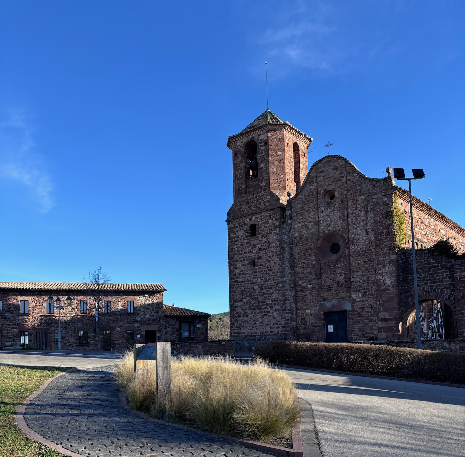
- You should see this building when you arrive
 2. Take the Camí del Brull a Aiguafreda
 - Best to set the masia’s address in your GPS now: https://maps.app.goo.gl/6Lwoo21STjc8ip7s8
- From the Rectoria del Brull parking, take the paved road to the right, leaving the church behind you. You will see a basketball court on your right.
- Follow this road for about 5 km (around 10 minutes)
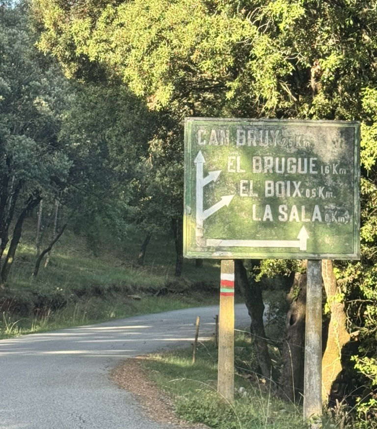
- You will see signs for four masias: Can Rovira, Can Boix, El Bruguer and Can Brull. Keep going in that direction
 3. Fork to El Bruguer
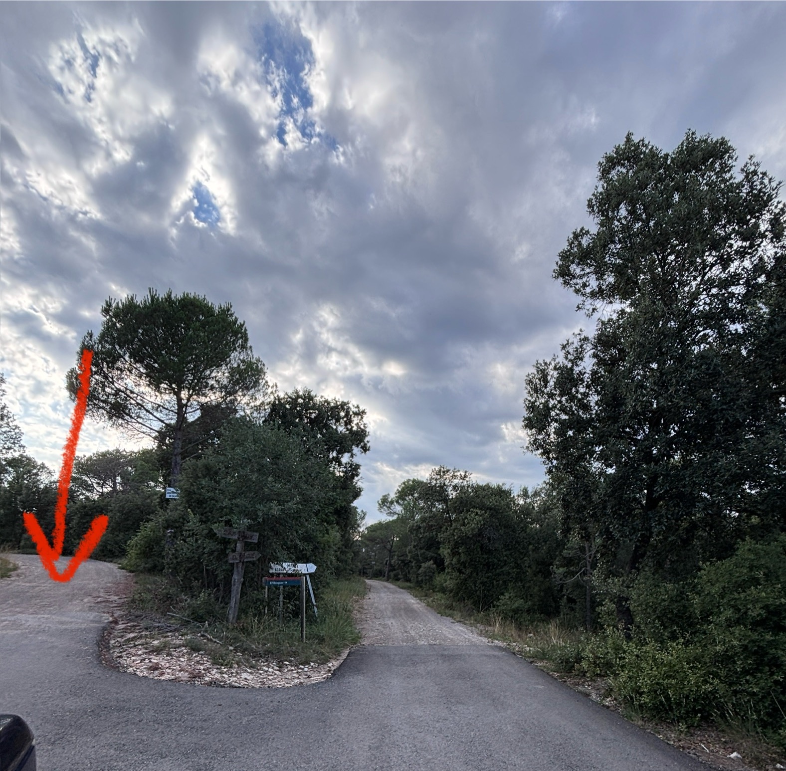
- Close to the property the road splits in two: the lower right branch goes to Granja Agraria El Bruguer (do not take it) and the upper left one to Can Bruy (take this one).
 4. Arriving at Can Brull
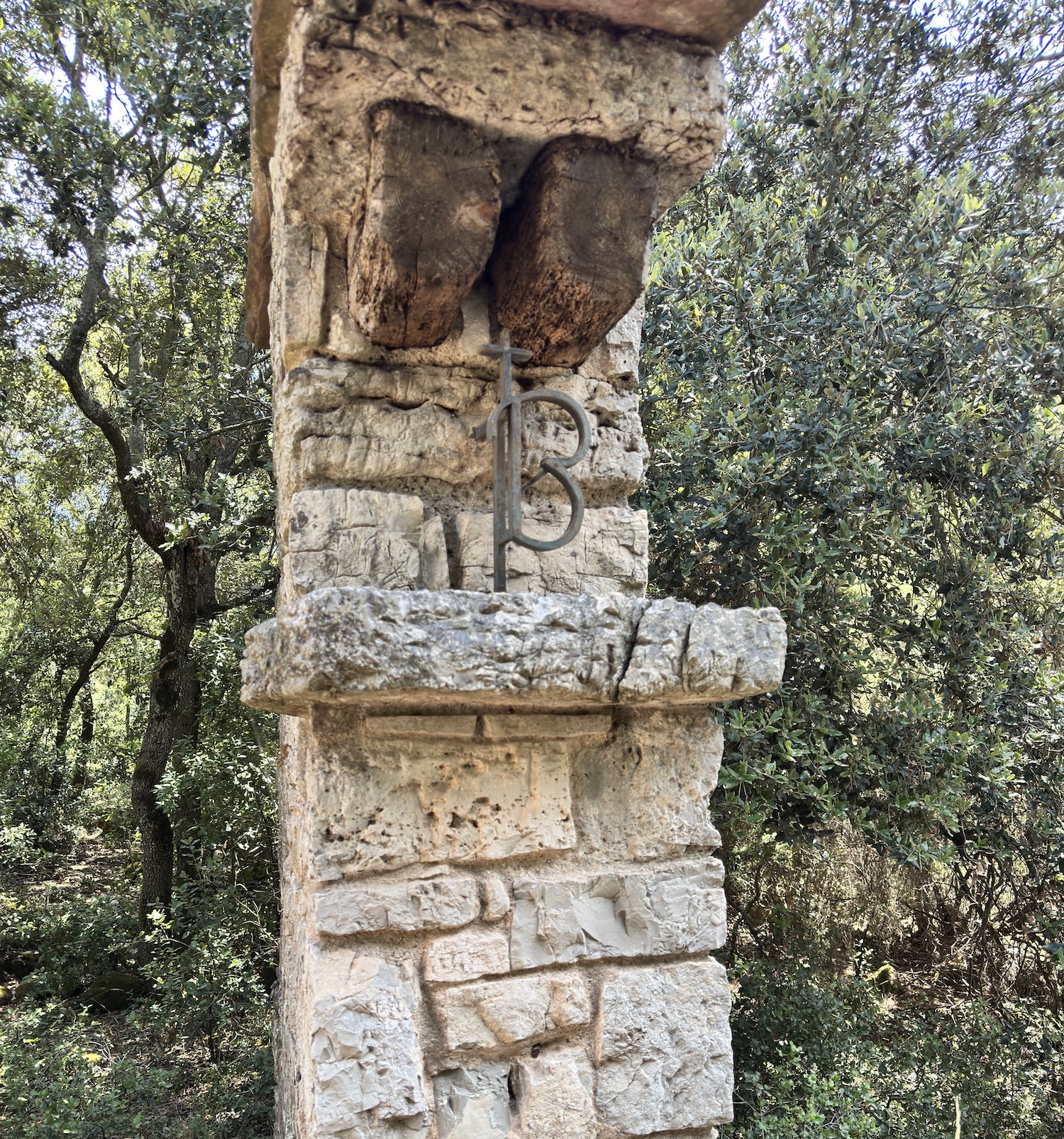
 - You will pass a first entrance with two stone pillars. On the left one you will see a B. Keep straight.
- The last 300 metres are a dirt and stone track.
- Reaching the property, the road forks again: take the lower right branch between two stone pillars; on the right pillar you will see the name Can Bruy. Continue on the right one
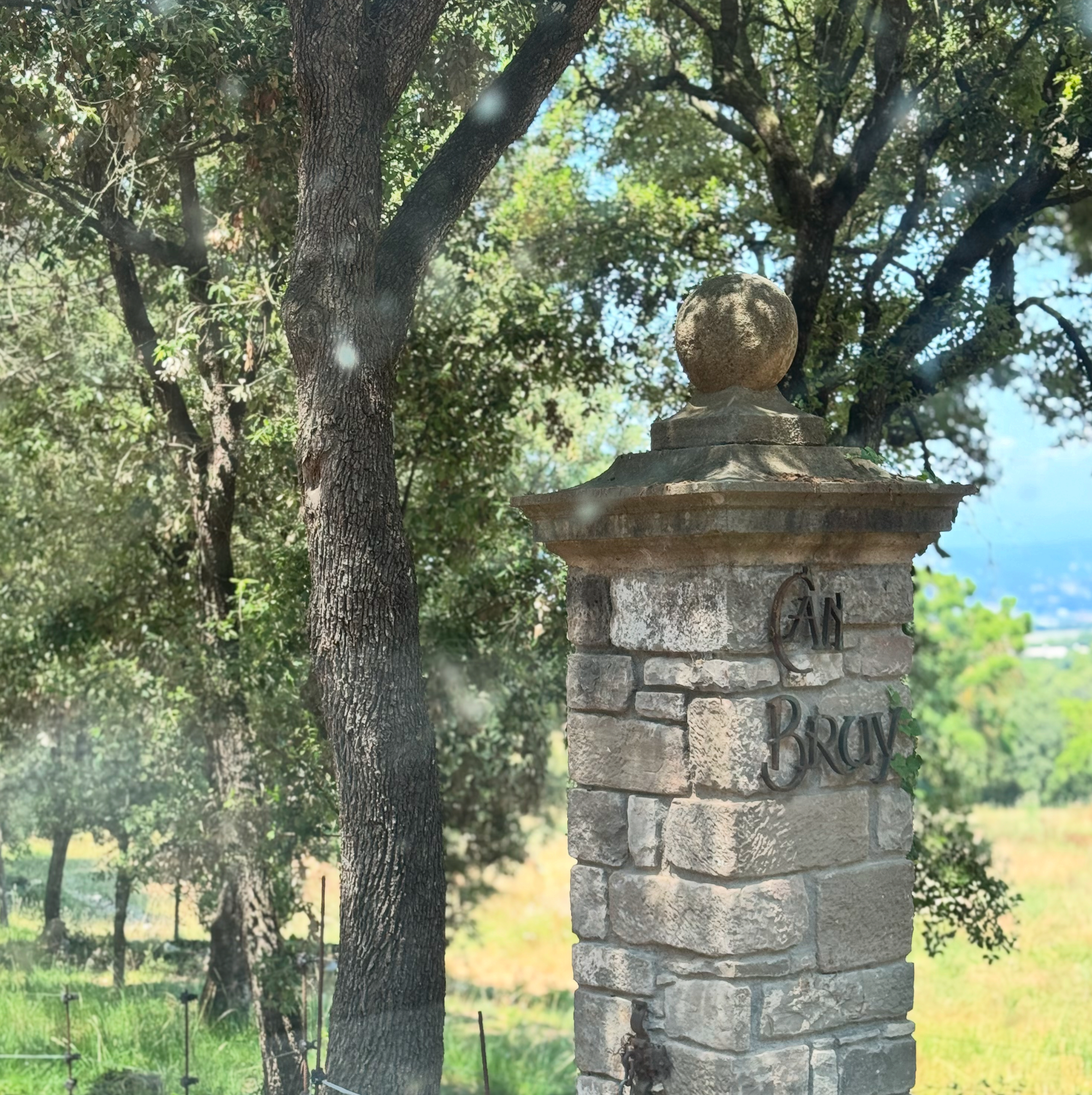
- Follow it straight to the house. You have arrived!
By public transport
Nearest train stations (Rodalies line R3)
| Station | Time from Barcelona | Notes |
|---|---|---|
| Centelles | ~55 min from Plaça Catalunya | More services |
| Balenyà-Tona-Seva | ~60 min from Plaça Catalunya | Alternative |
From the station
- You will need transport from the station (there is no direct bus)
- Contact us ahead to arrange a pickup
- Taxi from Centelles: about 15-20 €
Airport
- Barcelona El Prat (BCN), the main one
- From the airport: Aerobús to Plaça Catalunya, then Rodalies R3 to Centelles